Why do you need an LVIA?
A Landscape and Visual Impact Assessment can be more than just a planning tool


An in depth Landscape and Visual Impact Assessment (LVIA) can help ensure a sensitive design from the very beginning of a project which can save a developer time and money. But what exactly is an LVIA and does your project need one?
What is an LVIA?
An LVIA is an important tool to help design proposed change
but it is also a technique used to assess the effects off change on the
landscape. The LVIA helps inform planning decisions by identifying the effects
of new developments on views and on the landscape along with measures to mitigate any adverse effects. If the proposal is likely to have a negative
impact on the landscape, the LVIA usually forms part of a larger environmental
assessment.
Will my planning application need one?
Size doesn't matter in this case. The Local Planning Authority (LPA) usually identifies if an LVIA
is required at the pre-app stage. if your project is on the Metropolitan Green Belt, for example, it is highly likely that an LVIA will be
required regardless of the size of the project.
The good news is that through this assessment, a development has the potential to identify and resolve any constraints at an early stage which will not only help speed up the planning process in the long-term but will potentially reassure planning officers and neighbours about your plans.
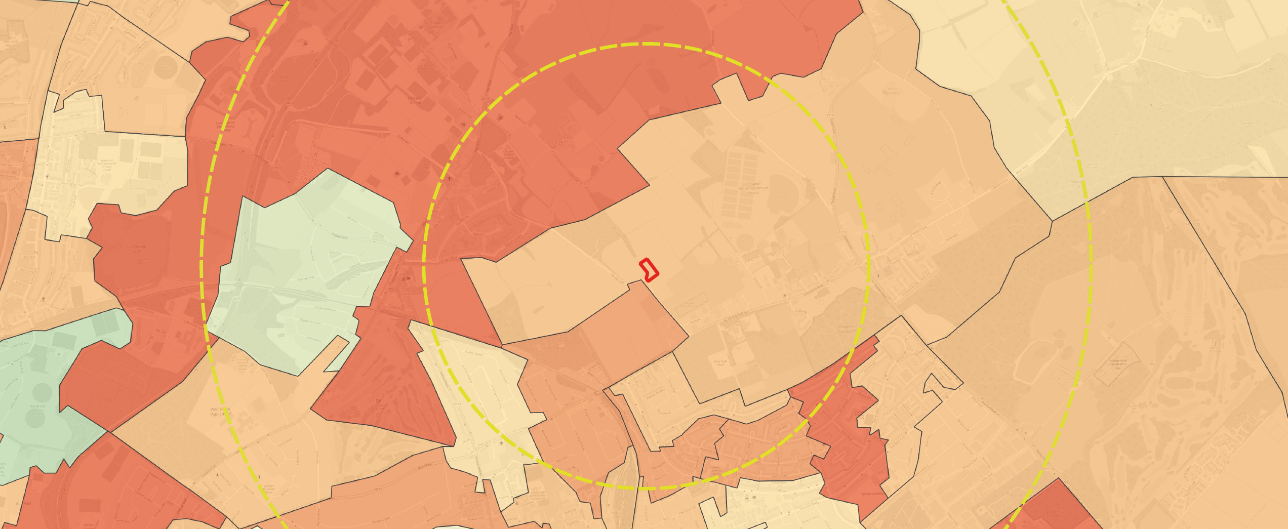
Soil Characteristics. Source: soilscapes
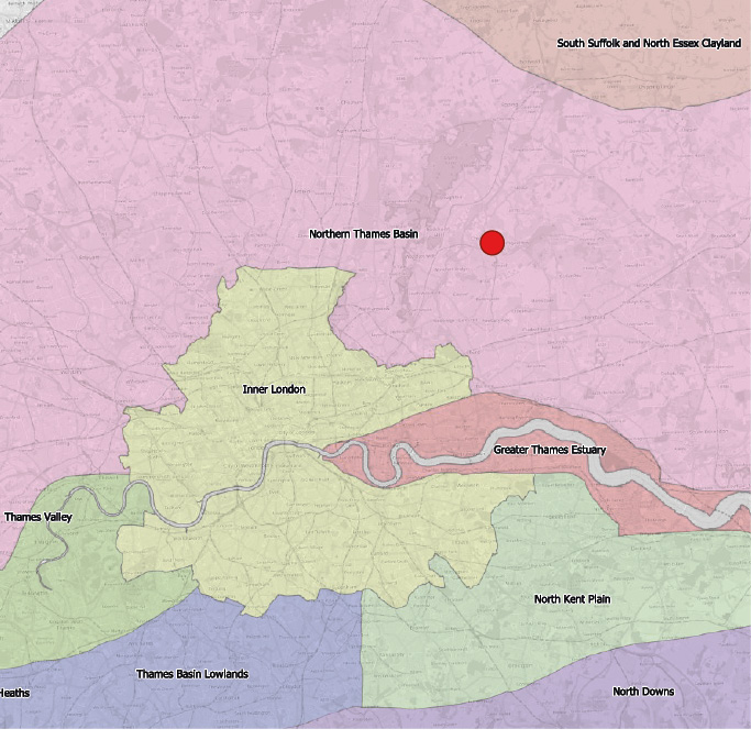
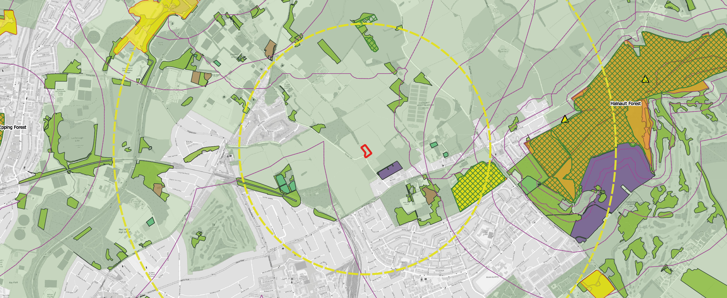
National Character Areas
What is involved?
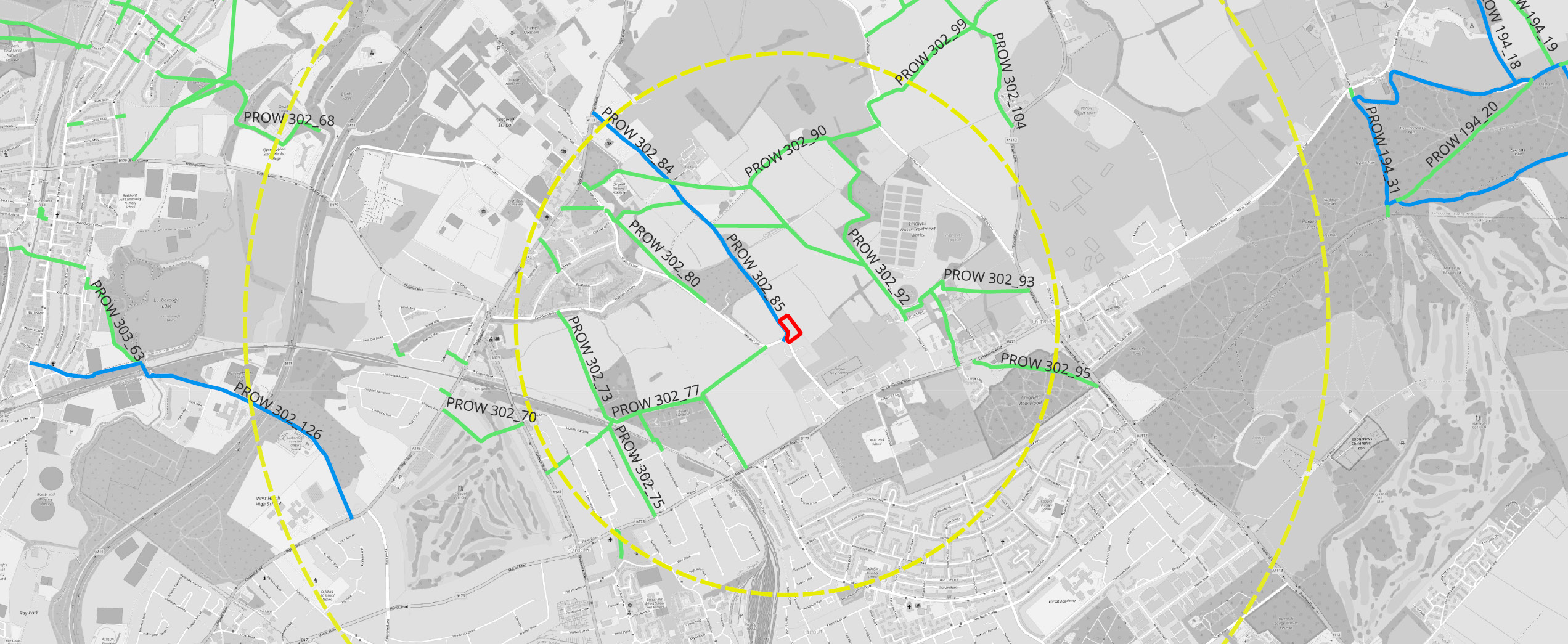
A baseline study through desktop research, mapping and site
visits
A Scoping stage to identify key issues and agree on viewpoints
Assessment of the effects
: the potential changes during the
project life cycle are predicted and the significance of these effects are
judged based on the magnitude of change and sensitivity of the landscape and visual receptors
Mitigation Measures
Comprehensive Report
that adheres to the ‘Guidelines for Landscape and Visual Impact
Assessment (GLIVIA, 2013)’ as endorsed by the Landscape Institute and IEM, plus
associated updates.
GLOSSARY OF TERMS
DSM
Digital Surface Model captures both the natural and
built features of the environment
DTM
Digital Terrain Model is a
raster elevation model created from laser pulses returned to a sensor and
captures the features of natural
Environmental Impact Assessment (EIA)
The
evaluation of the
effects on the environment of particular development proposals containing
reports from other professionals such as ecologists, hydrologists, and heritage
consultants.
Geographical Information System (GIS)
Computerised database
of geographical
information that can easily be updated and manipulated.
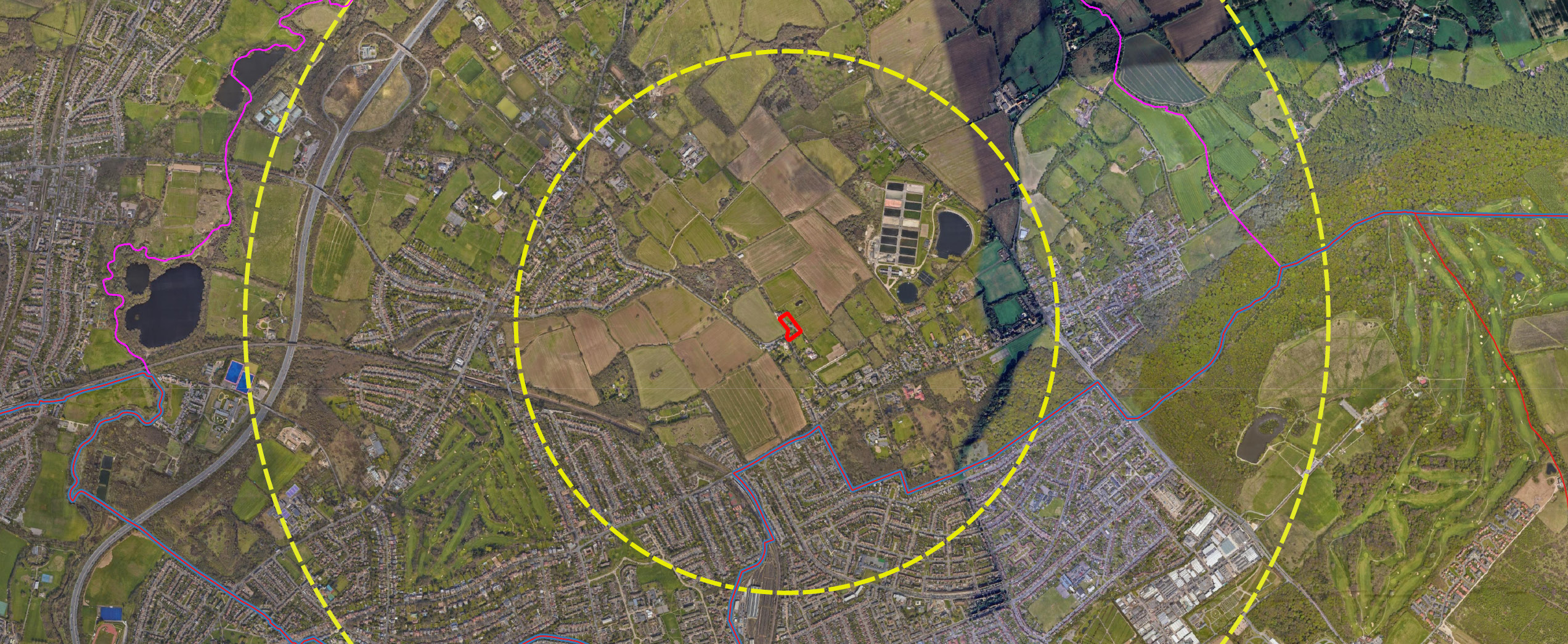
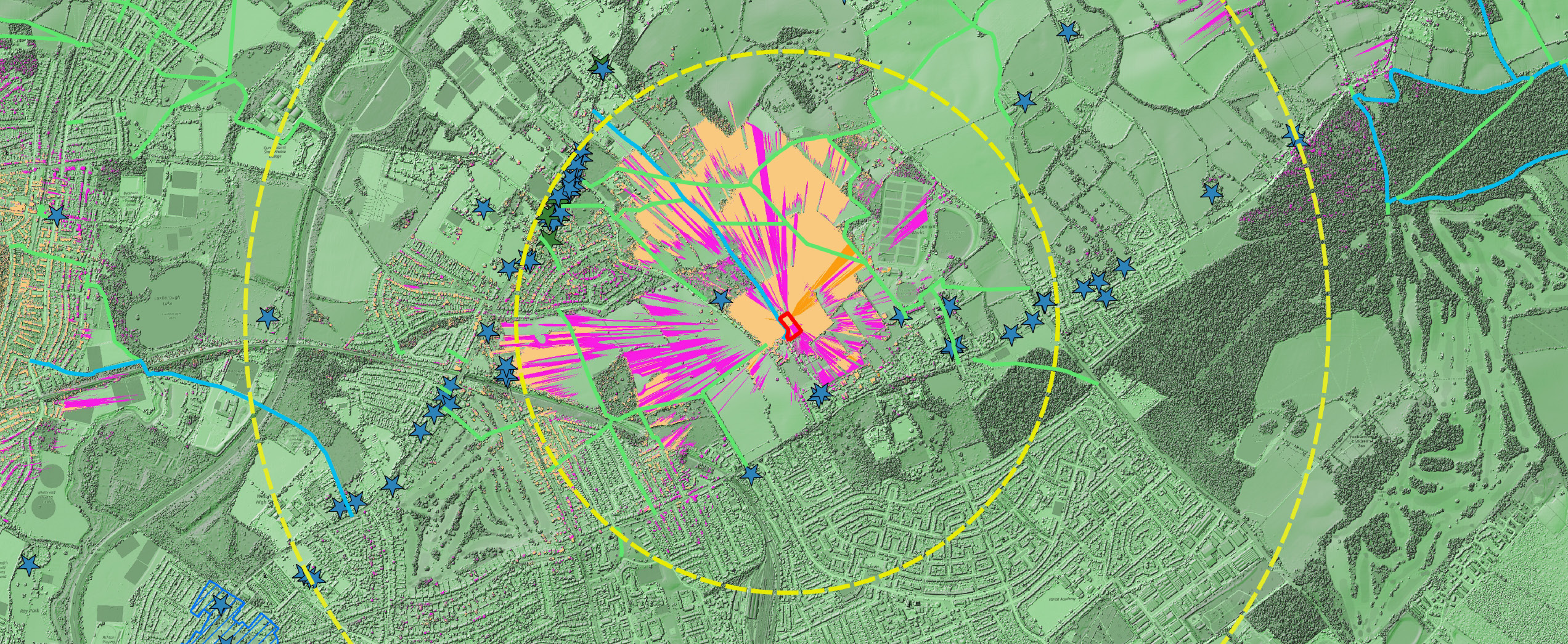
Zone of Visual Influence (ZVI)
Area
within which a proposed development may have an
influence or effect
on visual amenity.
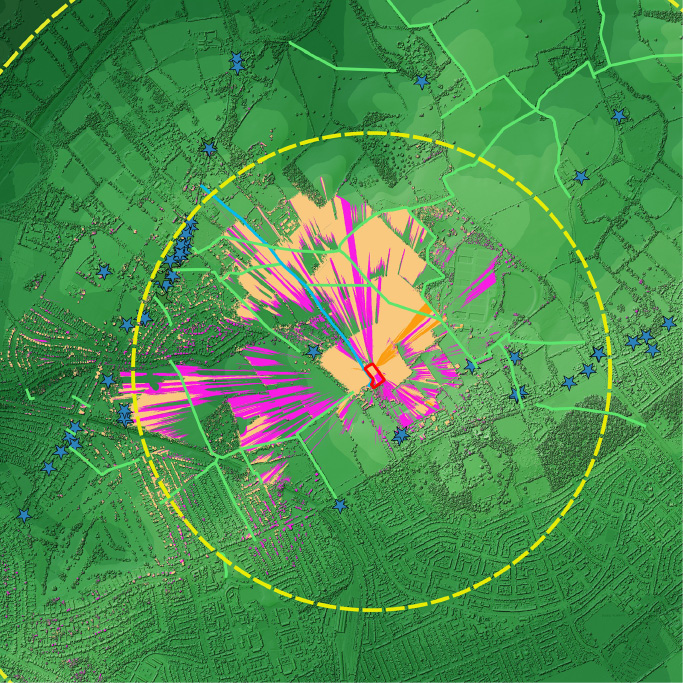
Zone of Visual Influence